Project Erebus // AI Fusion System
See what
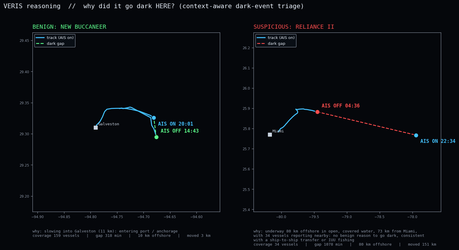
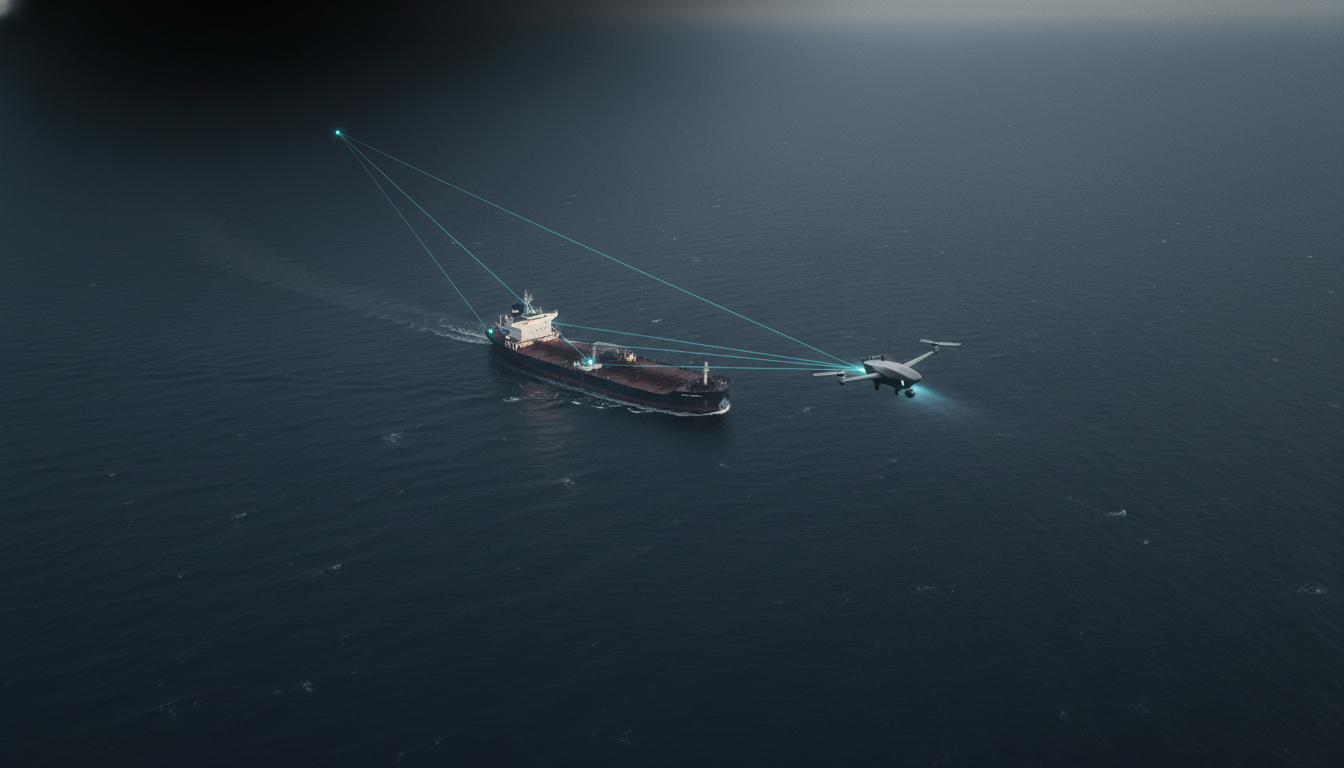
runs dark
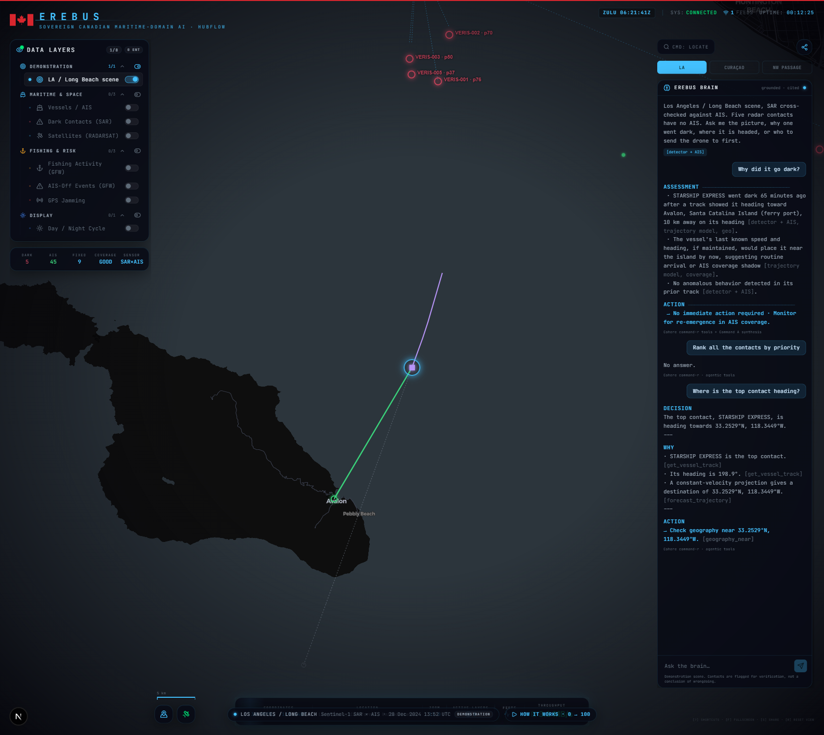
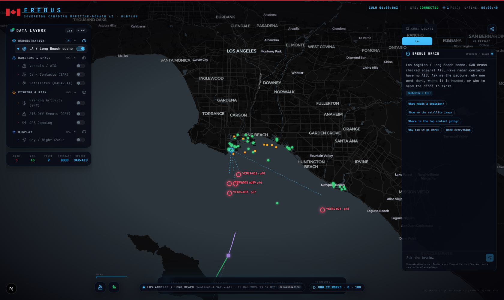
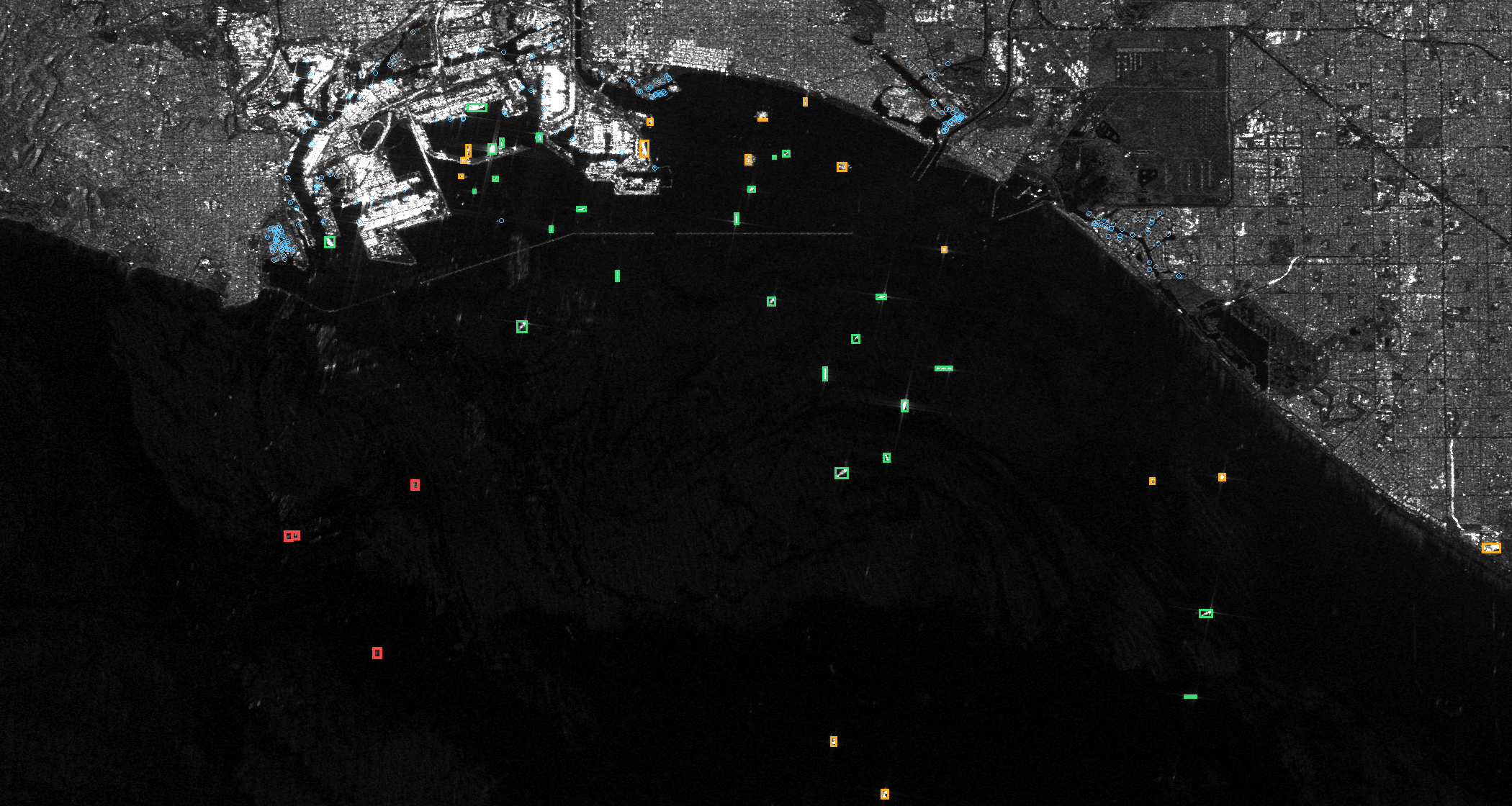
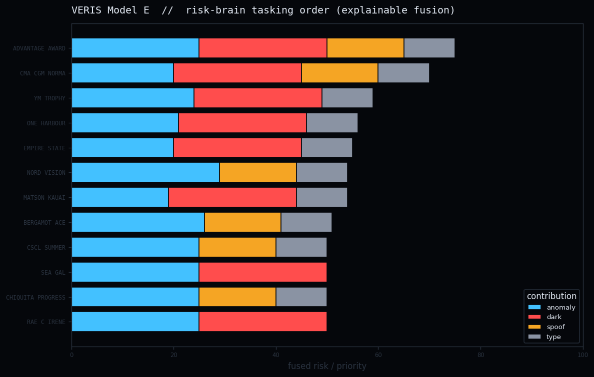
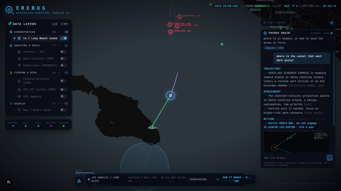
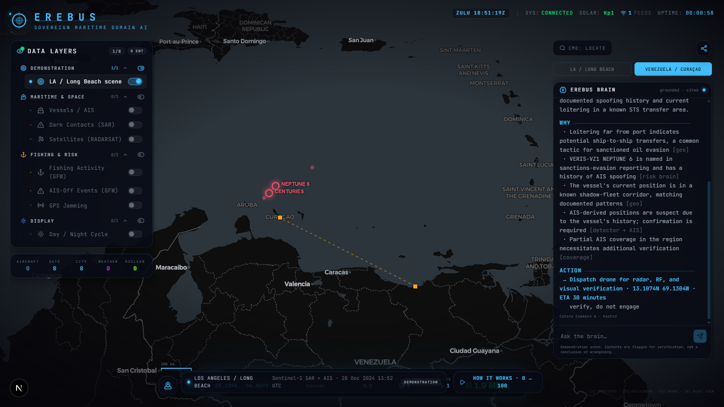
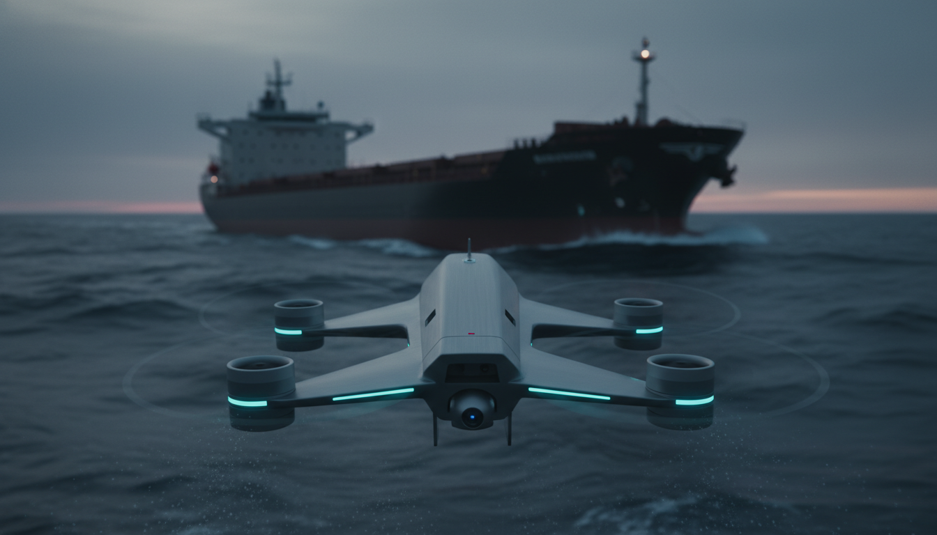
Canada's own AI fusion system for maritime domain awareness. Detection is solved; deciding what matters is not. Erebus sits above the sensors, ranks the contacts that need a decision, explains each call against its evidence, and points the low-cost drone sent to verify. Built to run on your own infrastructure.
Scroll to discover ↓